Showing posts with label Public Transport. Show all posts

Tuesday, February 25, 2020

Super-charabanc Peoplemover

Greetings from the Australian National University where Dr Antonia Terzi is speaking on the engineering of the Superbus. This is a prototype high speed people mover. It looks like a stretched super-car, to carry 23 passengers. This is not a practical transport system, but an interesting marketing exercise. Dr Terzi detailed the engineering of a vehicle which could travel at high speed, but also through city streets. However, the aerodynamics would be irrelevant in reality, as a bus (or as this would be more accurately called a "Charabanc"), would not operate at high speed for a significant amount of time.

Artist''s impression of Brisbane Metro Vehicle.
From Brisbane City Council
There have been similar examples of making public transport look attractive to the public. An example are the vehicles for the Brisbane Metro. The articulated buses for this service are being fitted with streamlined noses, and wheel covers, to make them look like light rail. The streamlining and wheel covers have no practical function: they are purely decorative, but are very important to making the service acceptable to the public.

Bishop Austrans Pod
An example of good engineering with poor marketing input was the Bishop Austrans rapid transit system. Australian company Bishop Austrans rapid transit system. This used people-mover sized vehicle pods,  on a light track. Bishop engaged CSIRO to model how many pods would be needed for a given number of customers. Bishop's pods are very similar to the superbus, both being based on automotive technology adapted to on demand public transport. However, Bishop's pods were very unexciting, looking like something from an old science fiction movie, whereas the superbus looks like something from a new movie.

Dressing up a public service in an unnecessary streamlined shell may seem a waste of engineering talent. However, engineering is of no value if the public doesn't want the products produced. One way I suggest this can be does is by providing entrepreneurial training.

Tuesday, April 30, 2019

Canberra Trams Working but Need Safety Improvements

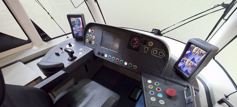
On Saturday I took my first ride on Canberra's new light rail system. The trams work, are fast, and reasonably comfortable, but some improvements need to be made to the information systems, and the safety of the network.
In late March I suggested to the Minster and Transport Canberra, some improvements for the safety of Canberra's trams. Here is the reply:
"Hi Tom, thanks for contacting us.

 Automatic Train Protection is a range of different signalling technologies that have been adopted to varying degrees across train networks in recent times. Only small parts of the Australian train network currently operate ATP. It is based upon (train) railway signalling systems that are utilised on train networks but not light rail/tram networks. There has been no adoption to date of ATP in light rail/tram networks.

Once the ATP technology is developed for light rail/tram systems it is expected most operators across the world will examine whether it is suitable and required for their networks.

Thanks, TC." Apr 2, 2019, 3:33 PM
In my view it would have feasible to at least install automatic stopping at stop signals for the trams, given far more sophisticated automatized systems are provided by the contracts in Europe.

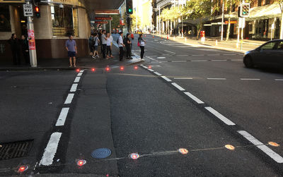
Neither TC nor the Minister replied to my suggested upgrades to pedestrian crossings. However, one safety improvement I did notice at the  Macarthur Avenue stop, was a large retro-reflective sign "< LOOK>" had been painted on the pedestrian crossing. This is well placed to be seen by people looking down at a mobile phone while walking. However, the yellow sign is not as easy to see as you would expect. These signs are normally applied to a black road surface, and are harder to see against the gray concrete of the tram line. I suggest the signed be given a dark background, to increase the contrast.

The electronic signs at the stop proved to be confusing. These display the last stop on the line in large letters with a number next to it: "GUNGAHLIN PL 6". Another passenger asked me if this was the right platform for Gungahlin, and it too some time to work out what the sign meant. After a few seconds under this in small letters appeared "TO: Gungahlin 23 min". As the trams were supposed to be running every 15 minutes this made no sense. Then the large digit changed to "5" and I worked out this was a countdown to the next tram, and the smaller display was the one after that.

The tram arrived as per the sign, and I got on to what was a moderately crowded service. Even so I was able to get a seat. The trams are very similar to those on the Sydney and Newcastle lines. The ride was much less smooth than the older Newcastle line. The tram swayed from side to side, jerked over bumps, stopped and started with a jerk, and squealed around the corner at Epic. This is surprising for a new installed system. At one location I noticed what appeared to be welding metal left on the track, which may have added to the bumpy ride and indicates poor instantiation and testing of the track. Also at one point in my travels, the tram stopped suddenly, sending standing passengers sprawled onto the floor, fortunately without any apparent injuries.
not as
I alighted at Well Station Drive stop. Unfortunately the pedestrian crossing at this stop only has the "< LOOK >" sign on the road side of the crossing. It would be very easy for someone to step off the tram, and under the path of a tram coming the opposite way. I suggest "< LOOK >" be added to all crossings.

The Green Shed had posted to Facebook, pointing out there was now a stop near their second had store at the Mitchell Resource Management Centre (aka "The Tip Shop"). The information sign at the tram stop directed me to the center. However, I could not find a footpath from the stop to the center. Worse still, the bicycle path which previously ran beside the road was moved to the roadway, and the previous path plowed up. I watch as someone tried to pull their wheeled shopping bag over this broken path. I suggest the path be repaired.

I continued my journey to the stop at the end of the line: Gungahlin Place. As the doors opened, a flustered transport officer told us to alight from the other side of the tram. This was confusing as an announcement had just told us to use either side. The staff were having difficulty coping with the large number of passengers, and had sensibly decided to have them enter one side, and exit the other. But the onboard system needs to be changed to say this. Surprisingly, the pedestrian crossing here at the terminus was also not well marked. My return journey was uneventful.

The next day I took the tram to Civic. One pleasant surprise was a new coffee shop, "The Coffee Store", at the corner of David Street and MacArthur Avenue, a short walk from the tram.

The Civic terminus was not as busy as Gungahlin had been the day before. I noticed temporary barriers at the end of the platform, and at the crossing, to stop people walking into danger. I suggest these should be replaced with permanent barriers, and extended along the approaches to the platform. There was a passenger sitting on a raised concrete plinth next to the platform, with their legs dangling over the track. A transport officer quick, politely, but firmly told them to move. However, I suggest a barrier needs to be placed at this point, to stop passengers, deliberately, or accidentally going on to the track. Also I suggest fencing should be installed at the approaches to all stops, and crossings, to deter waling across the track. This could be progressively extended, until the entire route, from  Civic to Gungahlin is fenced.

The tram works, and will be an asset to Canberra. However, it does not work as well as that in Newcastle.

Saturday, March 30, 2019

Technology to Improve the Safety of Canberra's New Trams


Two recent incidents, a pedestrian was struck by a  tram, and a tram running a red light, highlight the need for safety upgrades to Canberra's light rail network, before it goes into regular service. Better markings and low level lights for pedestrian crossings, plus activation of Automatic Train Protection (ATP), would make the network safer. These have been suggested to Transport Canberra, and Meegan Fitzharris MLA, ACT Minister for Transport. These measures would save money, by avoiding accidents. Otherwise those who decided to not to install safety measures may need to explain their actions in the ACT Coroner's Court, if there is a fatality.

Mark pedestrian crossings

In a recent incident, a pedestrian was struck by a test tram. When using the tram crossing near the station at the intersections of Northbound Avenue and  Macarthur Avenue, I noticed the crossing was difficult to see, as were the indicator lights. The crossing is the same gray concrete as the path leading up to it, with no contrasting color to mark where to stop, or where the crossing is. There are Hazard Tactile Indicators to warn those with low vision, but these are also in a low contrast color, and difficult to distinguish from the concrete. The pedestrian indicator lights are high up on poles. It is therefore very easy to step out into the path of a tram.

On the day I used the crossing there was a laminated paper sign attached to the poles near the indicator lights. This sign warned to look out for trams. However, the sign was flapping in the wind, hard to read, and was distracting from the indicator light, so increasing the risk of an accident.
The tram crossings should, I suggest, be marked in a contrasting color, as the adjacent road crossings are, and lower lights added. Low level lights are being trialed in Sydney and Melbourne.

Install Automatic Train Protection


In a recent incident reported in the media, a test tram ran through a red light. This indicates that Canberra's trams are either not equipped with Automatic Train Protection (ATP), or it is not functioning correctly. With ATP the tram would stop automatically at a red light, preventing accidents. ATP should be fitted and functioning before the system is put into service.

Update: 1 April 2019


Canberra is full of otherwise intelligent people, but they do not stop at tram crossings. I suggest fences are needed along the track, and at stops, as well as better marking, and signals, at crossings. 
 
Yesterday I waited fifteen minutes for a bus on
Northborne Avenue (while trams rattled past empty). In that time I saw several people use the crossing adjacent to the MacArthur Avenue tram stop. None of these people even paused as they approached the crossing, they did not look left or right, just walked strait across the tracks. The same people did stop, and look, at the road crossings. Several people also walked across the tracks not at the crossing. It would be easy to say these people deserve their fate, but we need to build infrastructure for people as they are, not as we would wish them to be.

Sunday, November 26, 2017

Autonomous Electric Bus in Canberra

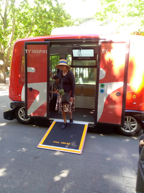
EZ.10 driverless electric shuttle bus from company Easy Mile, on demonstration run in Canberra's city center. Marghanita da Cruz steps out of the bus. The wheelchair ramp has been deployed, as part of a demonstration. This would not normally be used for ambulatory passengers.
Easy Mile EZ.10 Shuttle
Yesterday I went for a short ride on an EZ.10 driver-less electric shuttle bus from company Easy Mile, on demonstration run in Canberra's city center.  The bus traveled a few hundred meters through Canberra' central mall.  While it has a maximum speed of 40 kph, this was done at walking pace, as it weaved in between the street furniture.

The vehicle hold six people sitting in two rows facing each other and with room for another six to stand (or a wheelchair). There are very wide doors making entry easy. The vehicle is higher than it is wide and looks more like a cross between a lift and a golf buggy than a bus.

The ability of the vehicle to find its way between the obstacles in the mall was impressive, with a smaller turning circle than even a mini-van. Also it was able to deal with pedestrians who strayed into its path. When the vehicle's sensors detected a person it would first ring a bell (like that of an old fashioned street car), then slow down and, if the person was not out of the way, stop. No one seemed perturbed or frightened by the vehicle slowing making its way along.

There is also a  wheelchair ramp which can be deployed by the press of a button (the vehicle also kneels to make entry easier).

This would appear a practical form of transport around a university campus (the Australian National Universality could do with a half dozen such vehicles),  or a city center. It would be a useful way to get people to and from light rail and other more conventional forms of public transport.

Tomcar Military Electric Vehicle
While the EZ.10 is imported, this is an industry which Australia could enter. There are already Australian companies making small electric vehicles for farms, factories and the military. Our universities and high-tech companies have the expertise to design the software for the sensors to operate the vehicle.

The EZ.10 shuttle is on an  Australian tour it will be in Canberra today (Sunday) until 12 Noon and 1pm to 3pm, then Cairns from 4 to 8 December and Mooloolaba from 14 to 16 December.

Wednesday, July 29, 2015

Longest Guided Busway

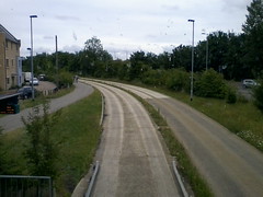
Cambridgeshire Guided BuswayThe Cambridgeshire Guided Busway has overtaken Adelaide's O-Bahn Busway as the world's longest. On Sunday I had a trip from Cambridge, to Huntingdon via St Ives. Most people in Cambridge may not even notice the bus-way, as in the city the specially adapted buses travel on ordinary roads and use ordinary stops.

If you look closely you will see small guide wheels (about the size of a small dinner plate) next to the front wheels of the buses. These contact the edges of the bus-way to steer the buses.

You board and pay for a ride like an ordinary bus (I took a double decker bus, with an excellent view from the front seats upstairs). One complication is that there are two separate companies provideing ser sercves and their tickets are not interchangeable: if you buy a return ticket from one company you cannot travel back on the other. You can use a smart card between both services, but these have to be ordered by mail and cannot be purchased on-lboard.

The bus-way starts just outside Cambridge, where the bus leaves the normal road, goes over a car trap (a pit in the center of the roadway to stop ordinary cars driving onto the bus-way)and onto the concrete tracks. The bus-way is mostly built like a concrete railway, with two wide concrete rails (one for each side of the bus) and a raised edge for the guide wheel. There is grass growing between the rails and between the two sets of tracks. The ride is quite bumpy as the bus goes over the joins in the track and also the bus sways from side to side (more so than I remember from the Adelaide bus-way). The swaying is likely more pronounced on the top deck of a double deck bus (Adelaide has had problems with swaying of the rear of articulated buses).

The bus-way follows a disused railway track and at times goes close behind houses, with a high sound barrier on each side (which you can see over from the top deck). Out in the countryside there are wetlands on either side, with people bird watching and fishing. At one point near St Ives there is a marina at the river.

There are several stops along the way with park and ride facilities and I noted one disused railway station. Between St Ives and Huntingdon the bus travels on ordinary roads. To get the guided bus-way experience you might as well just go Cambridge to  St Ives and back.

In 2009 I traveled the 12 kilometers, of Adelaide's O-Bahn Busway which was then the world's longest. The experience in Cambridge is similar. This is not a glamorous mode of travel (like a monorail), but a pratical solution to a particualr problem: where space in confined or ground too soft or undevne for a normal roadway to be built.

The o-bhan bus guidance technology is a simple and proven mechanical system. However, technology has advanced to the point where it should be possible to achieve the same result using electronics. Using automatic lane and cruse control developed for cars and trucks, it should be possible to have buses self steer in bus lanes and keep a safe distance from each other. This should make it possible for buses with no mechanical modifications to travel on an o-bhan bus-way, as well as one on an ordinary roadway. Also it should be possible to use positioning technology and communications technology to safely share one lane for two way traffic.  This would allow, for example, just one lane to be built and passing lanes at the bus-stops. Buses would take turns to use the lane, waiting at the stops (just as trains do on many lines now). This would greatly reduce the cost of the construction of bus-ways. At peak times buses could travel in convoys, with each automatically separated by a safe distance.

Sunday, February 22, 2015

Canberra Metro Needs Land Planning, Bus-ways and ICAC

The ACT Government is proceeding with work for a transit system for the City of Canberra called "Capital Metro". The Stage 1: City to Gungahlin, will use a route down Northborne Avenue, Canberra's main street. However, while the documents describe "Canberra’s gateway as a beautiful tree lined urban boulevard", it appears the government is taking a build it and they will come approach. The plan seems to be to first design a transport system and then work out what land use this will support along the route. I suggest reversing this and first deciding the land use for Northborne Avenue and then what is a suitable transport system.

Canberra is a low density city which does not require, and could not afford, a high capacity light rail system. An affordable option which will fit into Canberra's existing public transport infrastructure is a dedicated express bus lane displacing one existing lane of Northborne Avenue, plus bus bays. This will cost less, have higher capacity and lower greenhouse emissions than a light rail system on a new right of way.

It should be noted that the ACT Government previously proposed a light rail system from Civic to Belconnen, a decade ago. Unfortunately the documents relating to this appear to have been deleted from the ACT Government website. In my response I suggested the cheaper option of a bus-way, which was subsequently implemented.

A metro style transport system requires that the density of housing along the route be increased. This change in land use would need to be planned and receive community support. It would be a waste of public money if the metro was built and then the change in land use was not approved, due to public opposition.

Building a metro and an increase in Canberra's residential density will require an expenditure of many billions of dollars, either directly by government, or through franchises issued by government. As has been seen in other states, this can lead to corrupt practices by government ministers, public servants and businesspeople. Before proceeding further with the metro, the ACT should legislate to form an ACT Independent Commission Against Corruption (ACT-ICAC), with powers similar to the NSW ICAC, to investigate official corruption.

Wednesday, August 20, 2014

How is Value Added to a NSW Opal Card?

I purchased an Opal Smart Card for NSW public transport at a newsagent for $10 and was told it had $10 credit on it, but it did not. Registering the card online and attempting to add to the balance did not work either. The $40 top-up I requested was returned (with an SMS message saying:
The top-up requested on DD/MM for Opal card ending in 9999 wasn't collected and has been returned. Please do not reply to this SMS.
No explanation of "collected" was provided. But this may indicate that the card has to be used within a few days of money being added. My reason for getting the card was to travel from Sydney Central Station to the international airport by train. The buses in my vicinity are not equipped for the Opal card, so there is no reason, or way, to use it before then.
 
While the Victorian "Myki" smart card had some problems, at least I was able to put some money on the card and not have the money vanish.

Saturday, August 16, 2014

How Much Does a NSW Opal Card Cost?

I purchased an Opal Smart Card for NSW public transport at a newsagent for $10 and was told it had $10 credit on it, but it does not. I registered the card online  (this is optional you can have an anonymous one). This was reasonably simple to do and the system sent me a conformation SMS, which is useful. But I was surprised to find the card had a balance of zero. So I added $40 online (the minimum), the balance remained at zero for several minutes, before changing to $40. Other online translations only take a few second: why does the Opal system take minutes?

The other annoying aspect of the Opal card is the need for yet another smart transport card. This is my fourth Australian state smart ticket card (I already have cards for Victoria, ACT and West Australia). I only need one electronic tag to driver my car in multiple Australian states, why can't I use the one travel card across Australia? The reasons can't be technical, as these cards all conform to the same smart card standards. In fact I also have a card for Singapore which uses the same standard (as will the Vancouver Compass Card).

Monday, June 03, 2013

Canberra Free Centenary Loop Bus

Route 100 - Centenary Loop is a free bus around Canberra's major cultural institutions. It leaves from platform 10 in the city at the Sydney Building every 30 minutes and goes to the Australian War Memorial, National Gallery of Australia, National Portrait Gallery, Questacon, National Library of Australia, Museum of Australian Democracy, National Archives of Australia, Parliament House, National Museum of Australia, and the National Film and Sound Archive. This is a pleasant trip around the lake. The service is provided for all of 2013 for the Canberra Centenary.

Friday, April 12, 2013

High Speed Rail For South-East Australia

Mr. Anthony Albanese , the Minister for Infrastructure and Transport, released the High speed rail study phase 2 report, 11 April 2013. This looked at the feasibility of Melbourne, Canberra, Sydney, Newcastle and Brisbane being linked by high speed passenger trains. The report finds this technically feasible, with economic and environmental benefits, but media reports have concentrated on the high cost and long time scale of such a project. In my view the project would be politically and financially feasible if built in stages. The Sydney, Canberra, Melbourne sector could be politically justified by eliminating the need for a second Sydney airport and the treat of further aircraft noise over politically sensitive western Sydney electorates. The project could be funded from the sale of land in new "i-Towns" along the route.

Providing a high speed passenger train from Sydney to Canberra and Melbourne would eliminate most flights on one of the world's busiest aircraft corridors. This would free up slots at Sydney airport for other interstate and international flights. It would also allow Canberra to be the second Sydney airport.

Fast train access to regional Australia would allow the rapid development of new "i-Towns". This would relieve development pressure from Sydney and the sale of the developed land in the new towns would pay for the cost of the railway. The new towns would exploit broadband technology to the maximum, to make them attractive and also low cost to develop. Facilities such as an advanced hospital, university campus, offices and entertainment facilities would be integrated and on-line. The railway would provide rapid access to the city for services not available in town. The towns could be built at the same time as the railway, so that revinue from land sales would be avialabl;e quickly.

Wednesday, April 03, 2013

National Smart Transport Ticket Needed

While Adam Carey's article on the use of motor vehicle electronic toll tags on public transport was an April fools day joke, the idea has some merit ("E-Tags the go as myki take its toll, lobby group says", The Age, 1 April 2013). A traveler from NSW cannot use their MYKI card interstate, but a motorist can use their e-tag on a toll road interstate. This is not due to an inherent technical incompatibility between the smart card technologies, they all use the same standards. State governments have chosen to block the use of smart tickets interstate to protect their own revenue, inconveniencing the traveling public and increasing cost. If state governments wished them to do so, travelers could use their MYKI from Melbourne interchangeably with Translink go card Brisbane, SmartRider Perth, Metrocard Adelaide, and the future Opal card Sydney.

 The federal government could provide a forum to plan this interchange. The encourage states to cooperate, the federal government could threaten to use its banking powers to open up transport payments to all financial institutions. The contact-less smart cards issued by Australian banks are compatible with the state's ticketing systems and the federal government could require the states to accept these cards under federal banking legislation. Faced with ticketing competition from all banks, states are likely to be willing to cooperate as a second best option.

Friday, June 22, 2012

Solar Powered NBN Co Discovery Truck

HINO Hybrid TruckThe National Broadband Network Company (NBN Co), have a "NBN Co Discovery Truck" touring Australia to promote broadband use. The schedule says the truck is at Toormina today and then will be at Penrith (NSW) on 26 June. I saw the display in Canberra this week. This is a good display, but I suggest NBN Co need a smaller version of the truck for urban areas.

Co Discovery TruckThe NBN truck is a very large semi-trailer which requires a specially qualified driver, wide roads, a large set-up area and several staff. Also the display needs considerable amounts of electricity from a diesel generator.

I suggest NBN Co commission a smaller truck for inner urban areas. This could be small enough to be operated by one person with an ordinary car licence and use solar, or mains power, when set up for display.

Smallest trucks can have their engines "de-rated" so they can be driven with an ordinary car license. A small display on the back of such a truck could be powered from batteries, charged while driving and supplemented by a small solar cell. An ordinary outdoor power cable could be used to run the display for extended periods and a small generator used intermittently when there is no mains and no sun.

The display could be secured and automated so that one person could set it up and oversee it, but would not need to be present all the time.

Several companies make small hybrid trucks using similar technology to the Prius hybrid car. These small trucks are popular with parcel delivery companies and local councils, as they are most efficient for stop start traffic. One of these would generate enough electrical power to run a display for a day. One is the Hyno Hybrid Truck, from Toyota's truck subsidiary.

It should be noted that the idea of a traveling display of telecommunications technology on a truck around Australia is not a new one. Digital video expert, George Bray, ran the "TechTrek", around Australia, in 2002. George used a converted camper-van, sponsored by the Australian Government and technology companies, to survey the use of the Internet and demonstrate its benefits. This was reported by the BBC. The "TechTrek Final Report" (George Bray, May 2002) is available.

Thursday, June 21, 2012

Obtaining a Melbourne Tram Ticket

Next month I am speaking at an international conference in Melbourne. Most of the other delegates are from China and will be staying at the conference venue. I am staying in the city and so need to get to the venue. The Melbourne tram network is extensive and they has introduced a smart transit card ("Myki"). But working out how to actually buy a ticket has proven much more difficult than getting the equivalent electronic ticket in Istanbul.

There are plans for a Tourist Pack, for visitors, preloaded with $8. But currently if you click "visitor" on the "Which MyKi is for you?" page, you are advised to buy the regular MiKi card. Curiously, while full fee paying passengers are told that the card will cost $6, visitors are not told of this cost.

I attempted to purchase a MiKi card, with MiKi money already loaded on the card. Also I chose a registered card, which allows topping up the money online and a refund if the card is lost. This required filling in not only details of where I wanted the card sent, but my email and phone details, a user id, and password. The first few times I tried this the system rejected the transaction after I had completed several screens full of information. The text on one screen was overlapping and unreadable and in other cases the text I was trying to enter would not fit in the boxes, due to poor web page design.

After several attempts I was able to order a registered card. I then tried to order a non-registered card for someone travelling with me. In this case I could not work out how to order a card with money on it. I could order a card with no money on it, but that would be of no use, as there would be no way to use it for travel. Perhaps this as done for security reasons, as the anonymous card acts as essentially like cash. But it seems silly not to allow at least a small amount of money on the card, as without it the card is useless.

Several Australian cities have, or are introducing, smart transit cards. All these cards use the same technical standards and are capable of being interoperable. The Australian Government could boost tourism and lower carbon emissions by encouraging the state governments to allow their transit systems to accept each other's smart cards (just as toll roads accept interstate electronic tags). This would allow interstate visitors to use their current card and international visitors to pre-purchase a card.

Wednesday, April 11, 2012

Broadband and Train to Replace Second Sydney Airport

The NSW Premier, Barry O'Farrell, has proposed to use a high-speed rail line from Sydney to Canberra in place of a second Sydney airport. Canberra's airport could then be used for Sydney. This is technically feasible, but it might be necessary to extend the rail line to Melbourne to make it viable. Also I suggest the use of broadband to make new settlements along the route viable and to pay the cost of the rail line.

European experience suggested that a rail service between Sydney, Canberra and Melbourne would replace most air travel. Broadband access on the train would also make this form of travel more attractive and something much harder for an aircraft to provide. This would free up the existing Sydney airport for longer trips. Also some international passengers who currently land in Sydney and transfer to Canberra or Melbourne by air, would then instead land in Canberra or Melbourne.

Sydney to Melbourne is the second busiest passenger air route in the world, with 950 aircraft movements per week. A high-speed train could be expected to replace 90% of flights between Canberra and Sydney and 80% between Sydney and Melbourne. Assuming that also 20% of the international flights to Sydney were replaced with ones to Canberra and Melbourne, this would free up significant capacity in Sydney. The use of larger A380 aircraft will also increase Sydney's capacity.

The high-speed train could make new and expanded settlements in inland NSW viable, reducing infrastructure pressure on Sydney. The sale of improved land in the new settlements would be sufficient to pay for the rail line. Broadband Internet could be used to provide jobs and services quickly and at low-cost in the new settlements, making them more attractive to residents. As an example, shared offices could be provided for workers to telecommute from. New schools, TAFEs and university campuses could be built with computer equipped classrooms, allowing access to global education. Medical facilities with instant on-line access to remote specialists could be provided.

Sunday, January 01, 2012

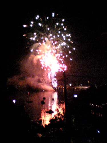
Fireworks Over Sydney Harbor New Years Eve 2011

You can't beat Sydney for a New Year's Eve experience. But getting to the harbor on the busiest night of the year can be difficult. I bought a MyMulti Day Pass, good until noon the next day on buses, trains, ferries and light rail. This is useful, as while getting on and off transport on new year's eve is not too bad in Sydney, queuing up to but a ticket can take a very long time. The pass works in the automatic turnstiles of the trains and ferries and on the bus ticket machines. On the light rail (tram) you show the conductor, who hands you a paper ticket (the private operator's system has not been linked to the state transport system yet). At really busy times, you can walk through the train and ticket barriers waving the ticket to the ticket collector.

On this trip I started in Sydney's Inner Weest and started with a STA 470 bus to the Lilyfield tram ( Sydney Light Rail) station. The station is under the highway on an abandoned goods line, complete with rusty sheds and disused tunnels. Joined a happy crowd carrying picnic rugs on the tram. Alighting at the Pyrmont Bay station, I was stopped from crossing the Pyrmont Bridge, at Darling Harbor, as I was carrying a bottle of Veuve Clicquot Champagne. Explaining to the security guards that I did not want to drink it on the bridge, I was escorted ten meters into the secure area so I could get to the Sydney Monorail Station, where I found that my ticket could not be used, turned around and was escorted back out of the security zone. To get to the city it was a matter of getting back on the Sydney Light Rail.

Exiting the tram at Capitol Square it would normally be a simple matter to catch any of the buses up George Street. But George Street was barracaded by police near Town Hall, so I joined a crowd of thousands walking up the road, watched over by mounted police on horseback. Sydney Town Hall Station had most entries blocked off (presumably to prevent revelers from falling down the subway stairs later in the evening. A friendly policeman showed me to open entry (outside Woolworths). AT this point I realized it would have been simpler to stay on the tram and get off at Sydney Central Station.

The first train to come along was full to capacity, but the next tree minutes later had some seats. The view of Sydney harbour from the train as it crosses the Sydney Harbour Bridge is worth the fare. On NYE the harbor is crowded with ships and all the foreshore is covered with people.

Wollstonecraft railway station turned out to have a view of the 9pm fireworks (as well as Sydney Harbor and the bridge, there are fireworks on many of the inlets, so fireworks could be seen over about 180 degrees. A path leads north from the southern platform of the station into Smoothey Park. over a very high footbridge over the ravine to St Giles Avenue. From here it is a 2 km walk to Greenwitch Point. Normally this would be a simple ferry ride from Sydney Circular Quay ferry wharf, but the ferries stop running in the early evening on NYE to allow for fireworks in the harbor. The ferry started again at 1:30pm making for a comfortable ridge back to the city. One thing to keep in mind that you do not necessarily catch the ferry in the direction you wish to go. In this case the ferry was traveling from the city and did not pick up passengers on the return leg. So it was necessary to get on the outward leg, to get back.

LinkLinkSydney was still alive in the early hours of the morning. The sensible people had windproof jackets and flat comfortable shoes. It was a long walk from the ferry terminal to the temporary bus stops around the CBD (necessary as the main roads were still closed in the center for party revelers).

Next time I might try to get a room at the YHA Rocks, which has a rooftop terrace, next to the Sydney Harbor Bridge, overlooking the Opera House..
Link Link

Thursday, August 04, 2011

Real Time Passenger Information System for Canberra Buses

The ACT Government has invited comment on a Real Time Passenger Information System (RTPIS) for Canberra's ACTION buses. The commuter survey closes 26 August 2011. Unfortunately the link to the survey form is missing from the Community Engagement page about the project.

The survey
canvasses options of web, mobile and SMS bus information, as well as screens at stations, major bus stops and shopping centers.

My preference would be for ACTION to make their web site compatible with mobile devices, rather than build a new mobile "app". They also need to ensure this meets accessibility standards for the disabled, as required by Australian law.

In addition screen should be placed at major stops, showing when busies depart. Obviously the same information should be provided free open access nonlinear via a standard interface to Google and anyone else who wants to use it.

Monday, August 01, 2011

Hybrid Sydney Bus

I photographed a hybrid bus on trial by the NSW State Transit Authority on the 370 route in Annandale, in the Sydney inner west. A media release described this as being a deseil electric hybrid which can run on battery power alone. But another option is a mild hybrid, running on natural gas, with battery power as a supplement.
"The hybrid bus will run on a small diesel generator, which either charges the buses’ electric battery or provides power directly to the electric motor if the battery is full. The motor, not the generator will drive the bus".

From: Hybrid Bus to Commence Trial in Sydney, Media Release, Carmel Tebbutt MP,

Tuesday, July 26, 2011

Stern Landing Vessels for Australian Military

65m Stern Landing Vessel design by Sea Transport CorporationSea Transport Corporation has proposed a militarized version of their Stern Landing Vessel (SLV) for use as a heavy landing craft for the Royal Australian Navy (RAN). The SLV design has been used for civilian passenger ferries. The vessel has a conventional "V" shaped bow at one end and a ramp at the other. This way the ship can travel efficiently in heavy seas and need only back into the beach to unload.

The 65m vessel depicted
would have a payload of 400 tons for the ADF Landing Craft Heavy Replacement (Phase 5 t JP 2048 Phase 3 of Amphibious Watercraft Replacement). The 2000Kw propulsion would give a speed of 15 knots and range of 2600 n miles with 83T fuel. This is about twice the capacity and speed of the current Balikpapan class LCH (Landing Craft, Heavy), over a similar range.

The SLV design has an open vehicle deck, typical of military landing craft. However, landing craft of the RAN tend to be used for general duties and rarely for beach landings. It might therefore make sense to build them with a covered vehicle deck. There would be space for a passenger deck behind the bridge (as with the JHSV) and a medium sized helipad above the rear vehicle deck. This would restrict the view from the bridge when beach landing, but video cameras could be used, along with large format high resolution flat screen displays to provide virtual windows on the bridge (also providing some protection for the crew).

The covered vehicle deck would be able to hold ISO shipping container sized equipment modules, as used on littoral combat ships. This would make for a versatile general purpose ship.

Wednesday, January 19, 2011

Bike Share Station in Melbourne on Oprah

Oprah's Ultimate Australian Adventure has one scene where Oprah walks with the Prime Minister Julia Gillard along the Yarra River in Melbourne. The walk past a row of shiny bright blue bicycles. This is an automated bicycle rental facility (called a "station"), part of the Melbourne Bike Share next to Sandridge Bridge, at Southbank (just across the river from Flinders Street Station). You can just see the solar panel powering the station in the photo of the PM and Oprah. I noticed the station when in Melbourne in August 2010.

Sunday, January 09, 2011

Public Information Symbols in Japan

The book "Symbol Signs" (AIGA, 1993) documents the development of the standard symbols for use in airports by the American Institute of Graphic Arts for the U.S. Department of Transportation. A similar process was undertaken in Japan by the "The Study Committee of Public Information Symbols" from April 1999. As with the US effort this was a joint private government partnership with the Ministry of Land Infrastructure and Transport and the Nippon Foundation. The Study recommended 125 Public Information Symbols in 2001.

The symbols are in eight categories:
  1. Public Facilities
  2. Transport Facilities
  3. Commercial Facilities
  4. Tourism,Culture,Sport Facilities
  5. Safety
  6. Prohibition
  7. Warning
  8. Mandatory
There are three grades (A, B and C), with "Grade A" having the most commonly used symbols. There is also a fourth category of "Existing", which is presumably of symbols in common use which the committee did not particularly like, but felt obliged to include.

The Symbols follow the style of the US AIGA DOT symbols and mostly use the AIGA recommendations, but have more detail. As an example, as well as an "Information" sign (small case "i"), there is a "question and answer" sign ("?").

The sample syvbmols are prtovided as 70 x 70 pixel PNG files. The sybmols are mostly monochrome in black on a white background. The safety signs are in green or red, prohibition signs in red and black on a white background and warning signs in black on a yellow background. PDF, EPS and GIF archioes are proveded of each set of symbols at higher resolutioons. However, the symbols are not provided as individual files at higher resolutions, making the m much harder to use.

Public Facilities

Grade A

  • Question & answer
    Question & answer
  • Information
    Information
  • Hospital
    Hospital
  • First aid
    First aid
  • Police
    Police
  • Toilets
    Toilets
  • Men
    Men
  • Women
    Women
  • Accessible facility
    Accessible facility(*1)
  • Accessible slope
    Slope(*1)
  • Drinking water
    Drinking water
  • Smoking area
    Smoking area
  • Smoking area
    Smoking area(*2)
  • *2 Use the symbol below wherever so required by the fire prevention ordinance.

Grade B

  • Check-in / ReceptionCheck-in / Reception
  • Lost and found
    Lost and found
  • Hotel / Accommodation
    Hotel / Accommodation
  • Tickets / Fare adjustment
    Tickets / Fare adjustment
  • Baggage storage
    Baggage storage
  • Coin lockers
    Coin lockers
  • Lounge / Waiting room
    Lounge / Waiting room
  • Meeting point
    Meeting point
  • Bank, money exchange
    Bank, money exchange
  • Cash service
    Cash service
  • Post
    Post
  • Telephone
    Telephone
  • Fax
    Fax
  • Cart
    Cart
  • Elevator
    Elevator
  • Escalator
    Escalator
  • Stairs
    Stairs
  • Nursery
    Nursery
  • Cloakroom
    Cloakroom
  • Dressing room
    Dressing room
  • Dressing room(women)
    Dressing room(women)
  • Shower
    Shower
  • Bath
    Bath
  • Water fountain
    Water fountain
  • Trash box
    Trash box
  • Collection facilitiy for the recycling products
    Collection facility for the recycling products

Transport Facilities

Grade B

  • Aircraft / Airport
    Aircraft / Airport
  • Railway / Railway station
    Railway / Railway station
  • Ship / Ferry / Port
    Ship / Ferry / Port
  • Helicopter / Heliport
    Helicopter / Heliport
  • Bus / Bus stop
    Bus / Bus stop
  • Taxi / Taxi stand
    Taxi / Taxi stand
  • Rent a car
    Rent a car
  • Bicycle
    Bicycle
  • Cable car
    Cable car
  • Cable railway
    Cable railway
  • Parking
    Parking
  • Departures
    Departures
  • Arrivals
    Arrivals
  • Conecting flights
    Conecting flights
  • Baggage claim
    Baggage claim
  • Customs / Baggage check
    Customs / Baggage check
  • Immigration / Quarantine / Inspection
    Immigration / Quarantine / Inspection

Commercial Facilities

Grade B

  • Restaurant
    Restaurant
  • Coffee shop
    Coffee shop
  • Bar
    Bar
  • Gasoline station
    Gasoline station
  • Cashier
    Cashier

GradeC

  • Shop
    Shop
  • Newspapers,magazines
    Newspapers,magazines
  • Pharmacy
    Pharmacy
  • Barbar / Beauty salon
    Barbar / Beauty salon
  • Baggage delivery service
    Baggage delivery service

Tourism,Culture,Sport Facilities

Grade B

  • View point
    View point
  • Athletic stadium
    Athletic stadium
  • Football stadium
    Football stadium
  • Baseball stadium
    Baseball stadium
  • Tennis court
    Tennis court
  • Swimming place
    Swimming place
  • Ski ground
    Ski ground
  • Camp site
    Camp site
  • Hot spring
    Hot spring

Grade C

  • Park
    Park
  • Museum
    Museum
  • Historical monument
    Historical monument
  • variant 1
    variant 1
  • variant 2
    variant 2

Existing

  • Nature reserve
    Nature reserve
  • Sporting activities
    Sporting activities
  • Squash court
    Squash court
  • T bar lift
    T bar lift
  • Chairlift
    Chairlift

Safety

Grade A

  • Fire extinguisher
    Fire extinguisher
  • Emergency telephone
    Emergency telephone
  • Emergency call button
    Emergency call button
  • Emergency exit
    Emergency exit
  • Safety evacuation area
    Safety evacuation area

Prohibition

GradeA

  • General prohibition
    General prohibition
  • No smoking
    No smoking
  • No smoking
    No smoking(*1)
  • No open flame
    No open flame
  • No entry
    No entry
  • No parking
    No parking
  • No bicycles
    No bicycles
  • No admittance
    No admittance
  • Do not rush
    Do not rush
  • Do not touch
    Do not touch
  • Do not throw rubbish
    Do not throw rubbish
  • Not drinking water
    Not drinking water
  • Do not use mobile phones
    Do not use mobile phones
  • Do not use electronic devices
    Do not use electronic devices
  • Do not take photographs
    Do not take photographs
  • Do not take flash photographs
    Do not take flash photographs
  • *1 Use the symbol below wherever so required by the fire prevention ordinance.

Grade B

  • Do not use prams
    Do not use prams(*2)
  • No swimming
    No swimming
  • No camping
    No camping
  • *2 Require supporting text

Grade C

  • Do not eat or drink here
    Do not eat or drink here
  • No uncaged animals
    No uncaged animals

Warning

Grade A

  • General caution
    General caution
  • Caution, obstacles
    Caution, obstacles
  • Caution, uneven access / up
    Caution, uneven access / up
  • Caution, uneven access / down
    Caution, uneven access / down
  • Caution, slippery surface
    Caution, slippery surface
  • Caution, drop
    Caution, drop(*1)
  • Caution, overhead
    Caution, overhead
  • Caution, electricity
    Caution, electricity
  • *1 Require supporting text

Mandatory

Grade A

  • General mandatory
    General mandatory
  • Quiet please
    Quiet please
  • Please stand on the left
    Please stand on the left(*1)
  • variant / Please stand on the right
    variant / Please stand on the right(*1)
  • *1 Require supporting text

Grade B

  • Line up in twos
    Line up in twos(*2)
  • variant 1 / Line up single file
    variant 1 / Line up single file(*2)
  • variant 2 / Line up in threes
    variant 2 / Line up in threes(*2)
  • variant 3 / Line up in fours
    variant 3 / Line up in fours(*2)
  • Directional arrow
    Directional arrow
  • variants
    variants
  • *2 Require supporting text

Existing

  • Close safety bar
    Close safety bar
  • Open safety bar
    Open safety bar
  • Get off
    Get off
  • Raise ski tips
    Raise ski tips
  • Skiers have to get off
    Skiers have to get off